
More about the book
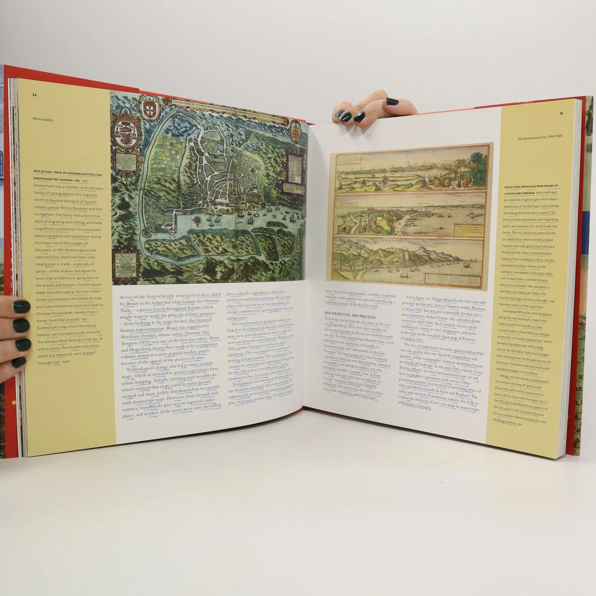
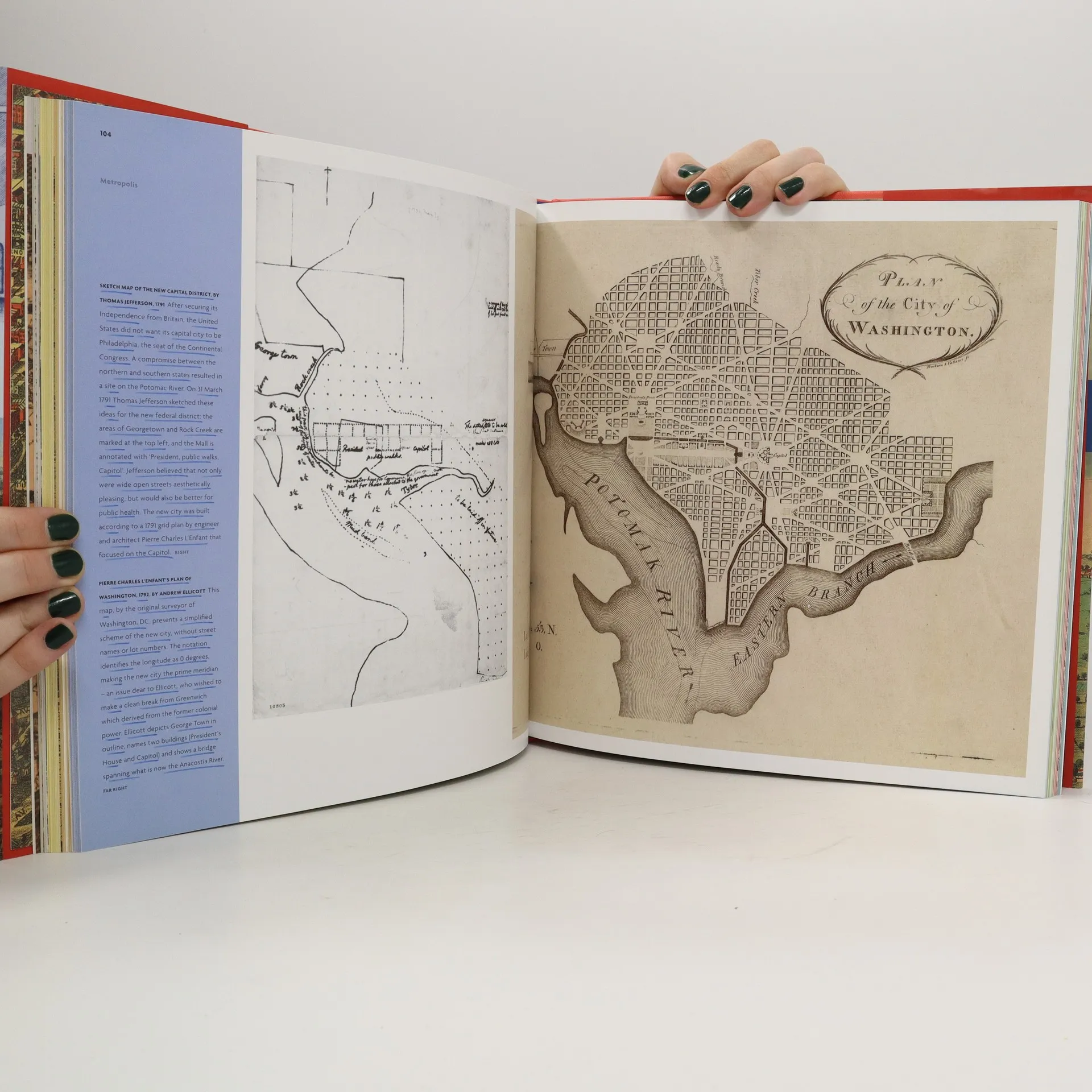
How the city was imagined in maps from ancient times to the present day.The a place of hopes and dreams, destruction and conflict, vision and order. The first city atlas, the Civitates Orbis Terrarum , was published by Georg Braun and Franz Hogenburg in 1572. For the first time, one could travel the streets of a city without leaving his or her armchair. Since then, our fascination with foreign cities has not abated. This sumptuous volume looks at the development of the mapping and the representation of cities, revealing how we organize urban space.From skyline profiles, bird's-eye views, and panoramas to the schematic maps of transport networks and road layouts to help us navigate, and statistical maps that can provide information on human aspirations, cities can reveal themselves in many ways. Focusing on key points in the development of urban representation and including retrofutristic visions of how we would be living today, this enlightening book illustrates some of the oldest, youngest, liveliest, and most contested cities in the world.Extended captions explain the relevance and elegance of each map, as well as the logic between its purpose and design. For anyone interested in the city in which he or she lives or with the desire to explore the history and culture of a metropolis overseas, this book is an enlightening companion.
Book purchase
Metropolis : Mapping the City, Jeremy Black
- Language

- Released
- 2015
- product-detail.submit-box.info.binding
- (Hardcover)
Payment methods
We’re missing your review here.