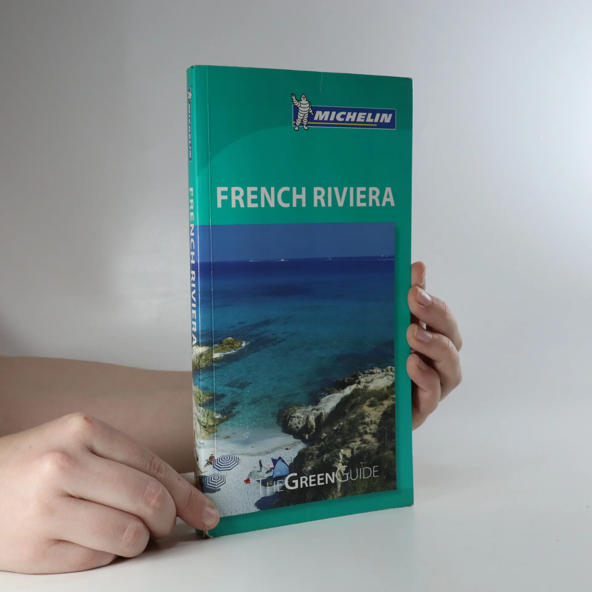
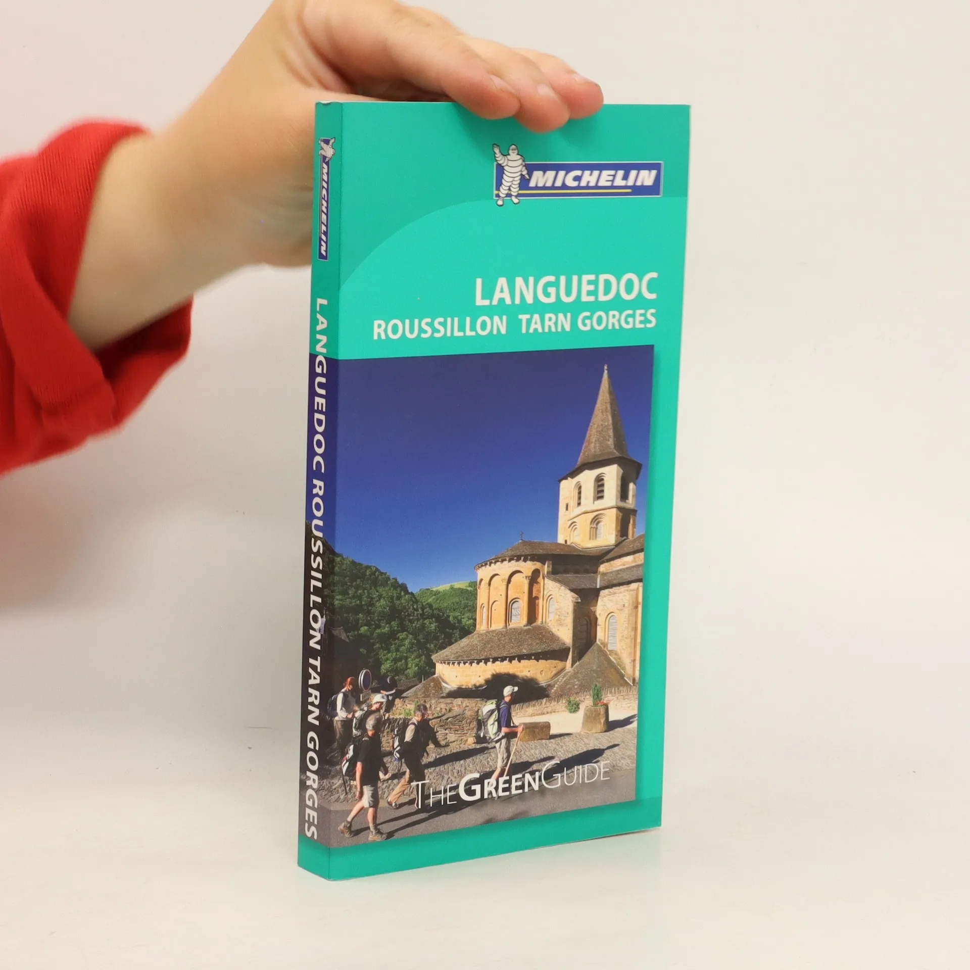
Michelin Green Guides are the perfect touring guide to explore countries, cities and regions around France, Europe and the World. The information-packed guide for singles, families & couples, helping you to plan before you leave.
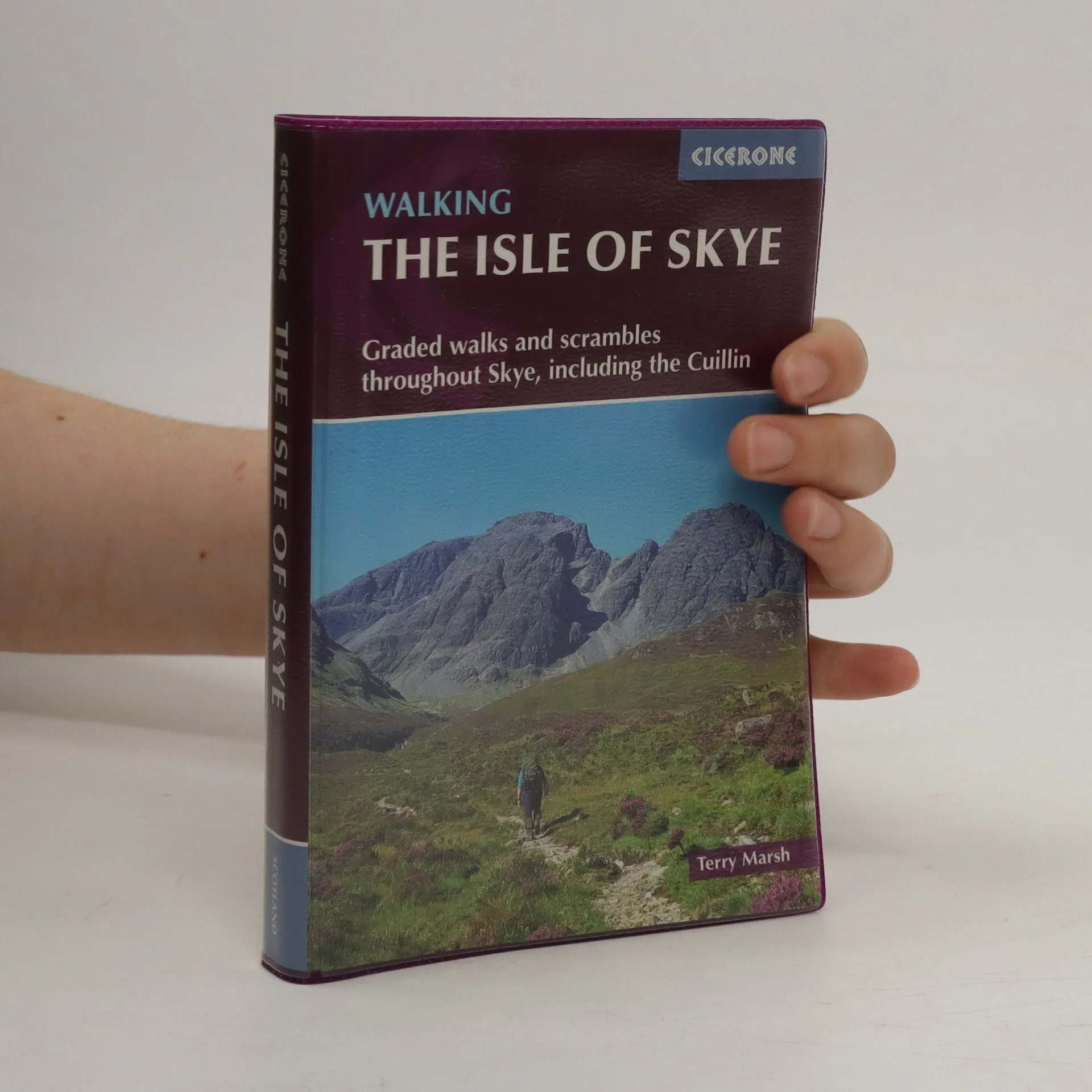
Guidebook with 87 walks and scrambles on the Isle of Skye. Walks visit the most awe-inspiring scenery on Skye, including Sleat and south-east Skye, Strath, Minginish, Duirinish, Waternish, Trotternish and the Cuillin. Walks range from coastal walks to Munros with exposure for experienced scramblers. Includes history, geology and local information.
Independent travelers seeking unique, enriching experiences and in-depth information on their destination turn to Michelin Green Guides, to make the most of every trip with Michelin s famous start-rating system, recommended tours and itineraries, and practical detail travelers need. Michelin reviews and rates all attractions to help make the most of time and travel funds. Designed for the discerning traveler, Michelin Green Guides feature comprehensive, detailed, yet concise travel information, allowing for careful trip planning as well as spontaneous on-site decision making."
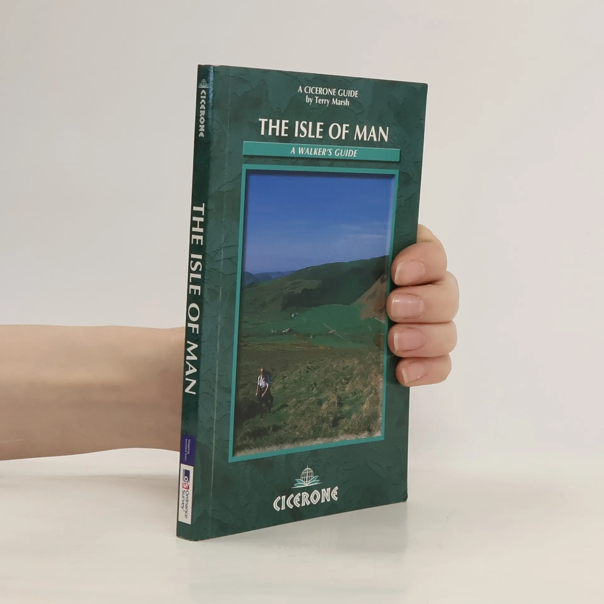
The Isle of Man walkers guide describes 40 walks all around the Isle of Man. The guidebook includes information (including history and Manx myth and language) to ensure a walking visit to the Isle is time well spent. Covers headlands, peaks (especially Snaefell), glens, coastal walks, beaches, cliffs.
A guide to 40 great mountain day hikes and scrambles in Snowdonia, Wales, UK. These inspirational new routes along the valleys and along the tops range right across the National Park and are divided into 8 geographical regions: Snowdon and Moel Eilio, the Glyderau, the Carneddau, Eifionydd, Siabod and the Moelwynion, Rhinogydd (the Harlech Dome), Migneint and the Arans and Cadair Idris and the Tarrens. All routes are graded, from moderate to strenuous, and illustrated with Harvey map extracts, topo diagrams by Mark Richards and lots of stunning photographs. Inviting the reader to experience less well-known regions as much as those that are eternally popular, these mainly circular day walks have been chosen to encourage independent exploration of the National Park, while offering clear guidance for those who prefer their walking days to be tailor-made. The author's deep knowledge of and passion for this much-loved region shines through.Some routes include mild scrambling or long days in rugged country, and many can be enjoyed all year round.
A guidebook to 40 diverse circular day walks suitable for walkers with
navigational skills. The Forest of Bowland and Pendle are two of north west
England's upland AONBs, perfect for walkers who enjoy exploring rough hilly,
sometimes pathless terrain. The routes include Ward's Stone, Pendle Hill,
Longridge Fell and Fair Snape Fell.
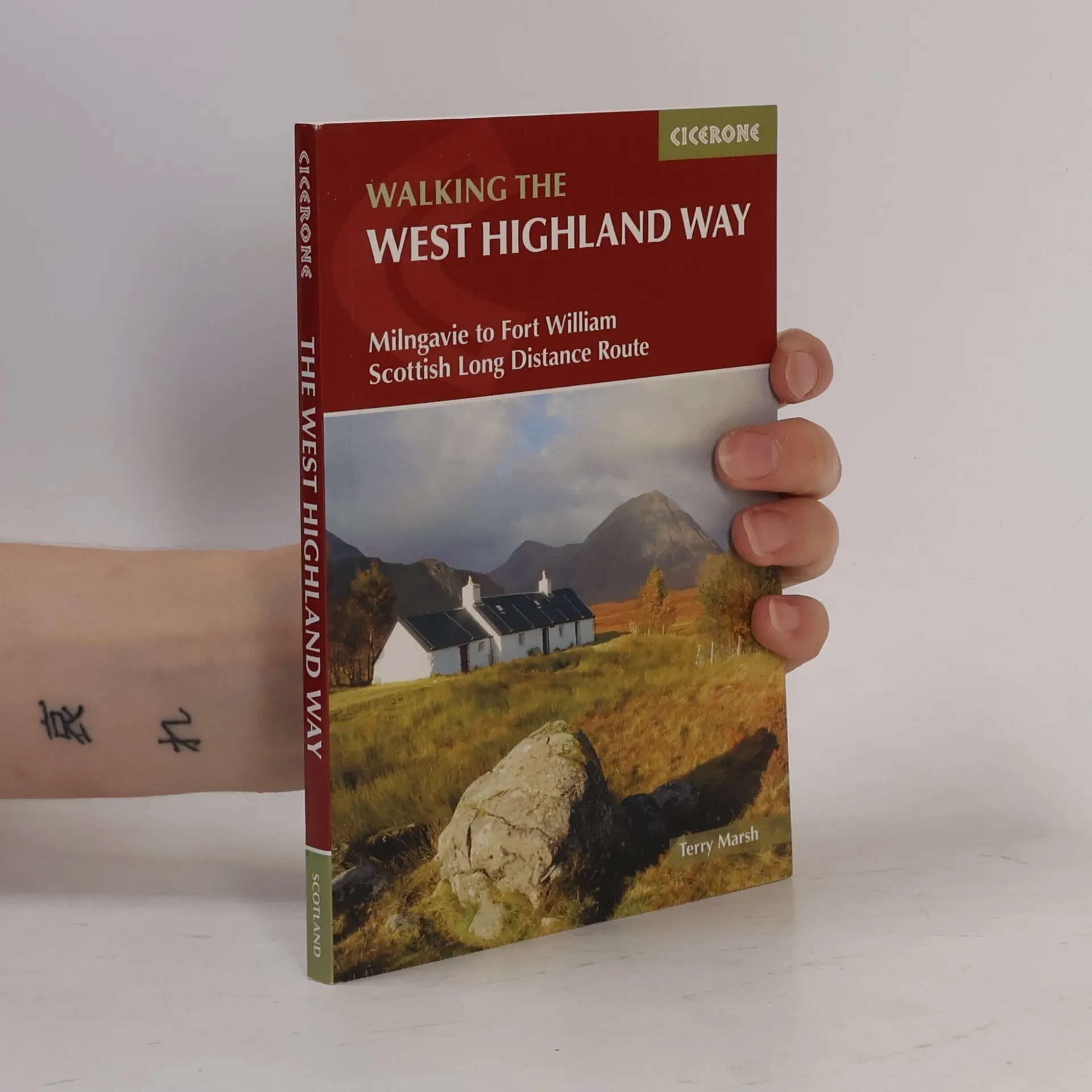
This guidebook, which includes a convenient separate booklet of 1:25,000 OS maps, describes Scotland's West Highland National Trail, a 95-mile walk from Milngavie near Glasgow to Fort William, passing Loch Lomond and crossing Rannoch Moor. Divided into 7 sections ranging from 8 miles (14km) to 20 miles (32km), the route can be completed in 6 to 9 days. Passing from the lowlands to the highlands, the West Highland National Trail captures the wild beauty of western Scotland, showcasing the splendour of glens flanked by great mountains, majestic moorland and sprawling farmland. Step-by-step descriptions of the route south to north are accompanied by a summary description of the route 'against the flow' as well as 1:100,000 OS mapping. A convenient separate booklet of 1:25,000 OS maps provides all the mapping needed to complete the trail. The guide also features a trek planner which highlights information about accommodation, facilities and public transport along the route.
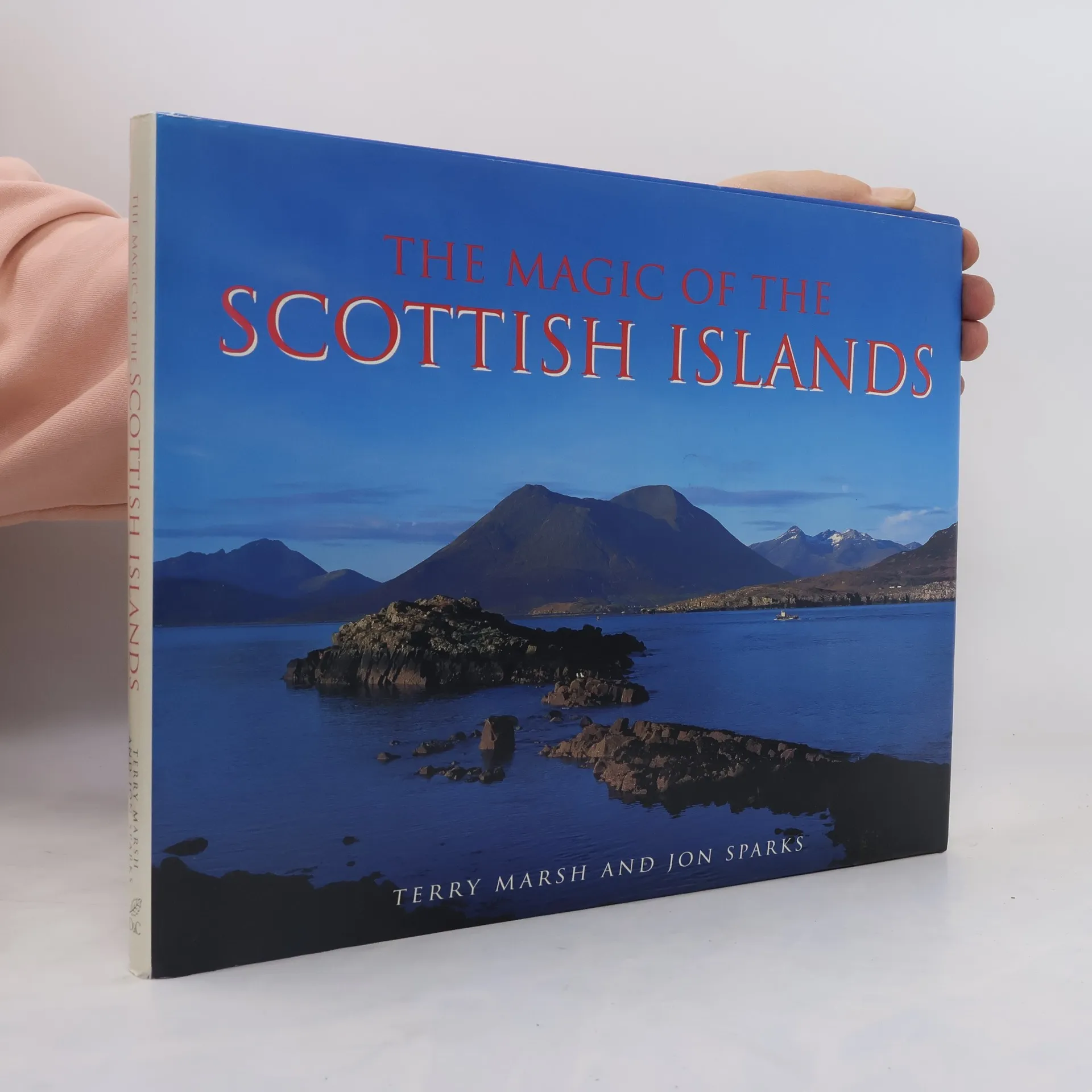
'I sat with my back against the pitted surface of the Ringing Stone on Tiree's northern shore watching grey seals at the water's edge and lines of low-flying tysties skimming the waves. Further out, a bright yellow fishing boat came and went with the swell, its rise and fall a lazy pulse against which life in the Scottish islands seems to be measured. Exposure to too much of this island magic, I thought, could mark a man for life, leaving him forever entangled in inexplicable enthusiasms for lazy days, bright blue skies, an encircling sea and the quiet ways of island nature.' In this book, Terry Marsh combines his written word with the evocative photography of Jon Sparks to portray the main island groups in all their moods, and to focus on what it is that gives these islands such magical and lasting appeal.
In the NATIONAL PARK GUIDE series, this volume introduces the Lake District. It details the geology and scenery, climate, vegetation and wildlife, man's influence: prehistory and history, myths and customs and explores the Park giving useful information on recreational opportunities and places of interest. The colour photographs are by Jon Sparks.